Model:

GDAS: "Global Data Assimilation System"

Updated:
4 times per day, from 00:00, 06:00, 12:00 and 18:00 UTC
Greenwich Mean Time:
12:00 UTC = 12:00 GMT
Resolution:
0.25° x 0.25°
Parameter:
Kind of precipitation
Description:
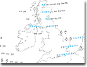
kind of precipitation   Rain or shower? This chart shows the kind of precipitation that is likely to fall given the atmospheric and surface conditions at a certain place.

The following table explains the symbols:

Precipitation Light Moderate Heavy
Rain
Rain shower
Snow
Snow shower
Sleet
Freezing rain
Cloud Cover 0-2 3-4 5-7 8
(eights)
GDAS
The Global Data Assimilation System (GDAS) is the system used by the National Center for Environmental Prediction (NCEP) Global Forecast System (GFS) model to place observations into a gridded model space for the purpose of starting, or initializing, weather forecasts with observed data. GDAS adds the following types of observations to a gridded, 3-D, model space: surface observations, balloon data, wind profiler data, aircraft reports, buoy observations, radar observations, and satellite observations.
NWP:
Numerical weather prediction uses current weather conditions as input into mathematical models of the atmosphere to predict the weather. Although the first efforts to accomplish this were done in the 1920s, it wasn't until the advent of the computer and computer simulation that it was feasible to do in real-time. Manipulating the huge datasets and performing the complex calculations necessary to do this on a resolution fine enough to make the results useful requires the use of some of the most powerful supercomputers in the world. A number of forecast models, both global and regional in scale, are run to help create forecasts for nations worldwide. Use of model ensemble forecasts helps to define the forecast uncertainty and extend weather forecasting farther into the future than would otherwise be possible.

Wikipedia, Numerical weather prediction, http://en.wikipedia.org/wiki/Numerical_weather_prediction(as of Feb. 9, 2010, 20:50 UTC).